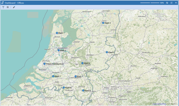
A map of locations in OneStream
Marking locations on the map makes your data tangible and clear. In this step-by-step guide, we'll show you how to effortlessly create a map, integrate GPS coordinates and make them clickable. The perfect foundation, in other words!
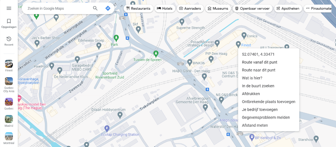
GPS coordinates
To mark locations on the map, of course, we need GPS coordinates. Go to Google Maps, right-click on your desired location and simply copy the coordinates from the menu.
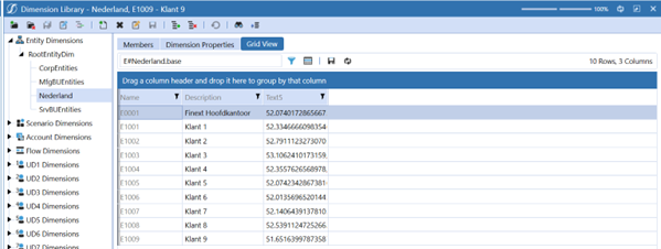
Dimensions
Navigate to your entity dimension, then click on "Grid View." Use the "Member Filter" to choose entities for your map. Filter by Name, Description, and Text 5 properties. Enter the GPS coordinates in Text 5 for each entity.
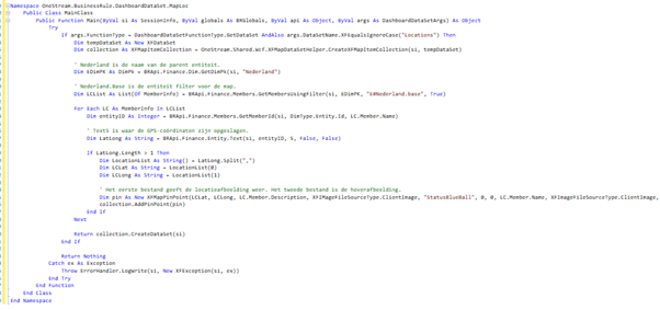
Coding
Create a new Business Rule, name it "MapLoc," and set the type as "Dashboard Dataset." Paste the prepared script into your new Business Rule.
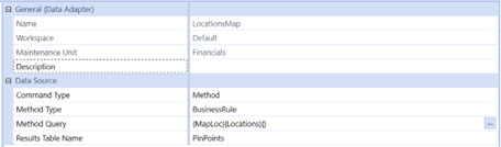
Data Adapter
Navigate to " Application Dashboards," select the DMU, and create a new data adapter named "LocationsMap." Fill in the fields as shown in the example below.
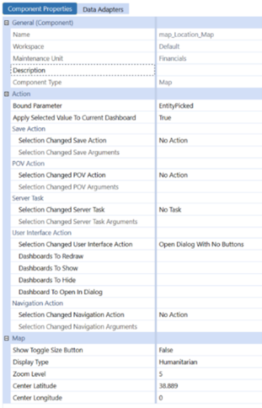
Map Component
Create a new Map Component and configure it as shown below.
Final result
Finally, add your map to the components of your dashboard, and that's it! With this map as a base, you can calculate distances between locations, open BI Viewers on location points and more!